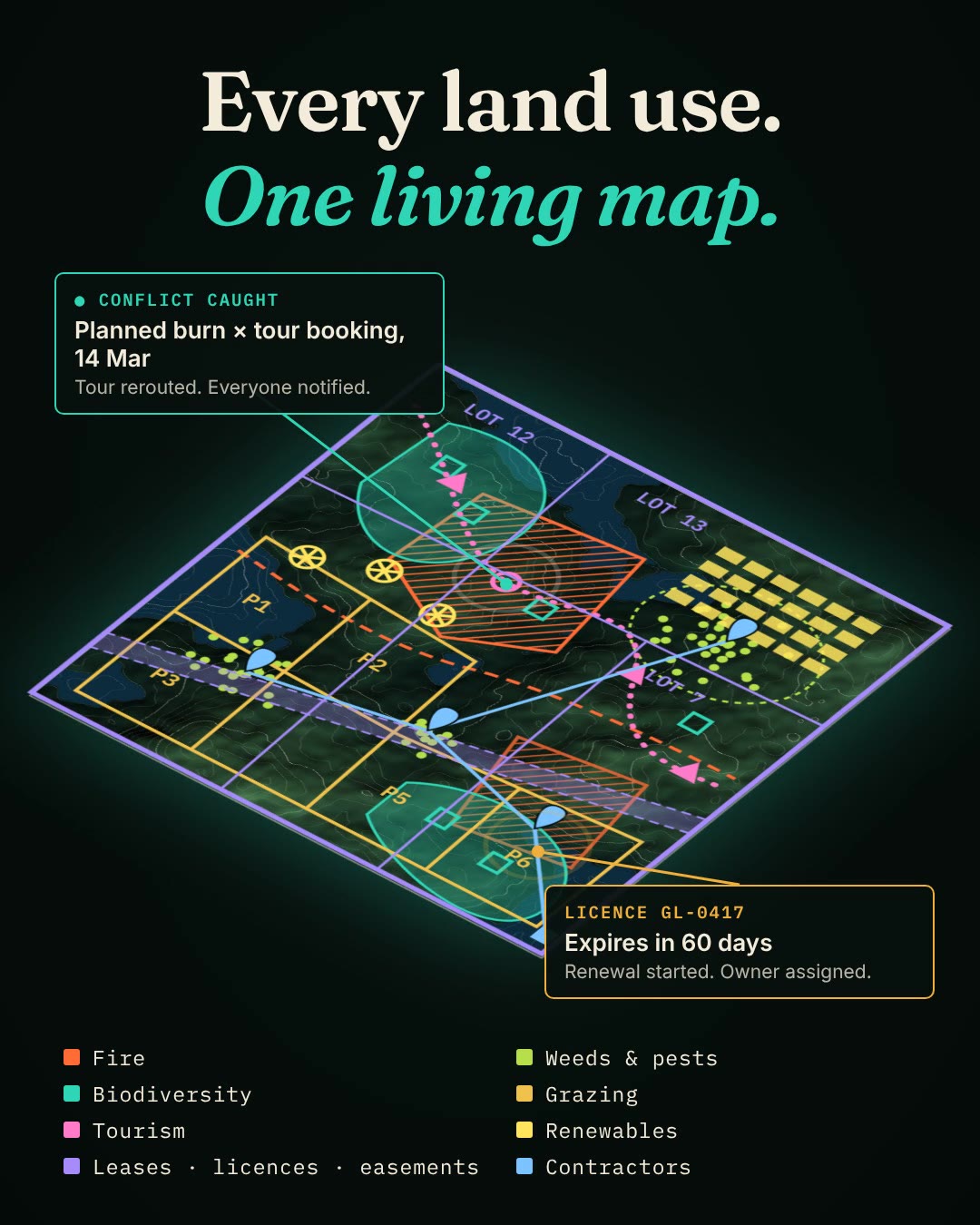
Every land use.
One living map.
A large property is usually run by six people using twelve tools that don't talk to each other. LandsTracker Cloud puts the whole property on one map, so the person in charge can see and run all of it.
One property. Six owners.
Twelve tools.
Nobody sees the whole property, so obligations slip, data leaves with the people who collected it, and conflicts surface on the day.
Fire, biodiversity, grazing, tourism, leases and the homestead are each run by a different person in a different tool: spreadsheets, inboxes, PDFs, a consultant's laptop. Each one works on its own. Together they don't.
- Land managerFire, erosion, weeds and works
- Ecological consultantSurveys, monitoring and reports
- AccountantRates, land tax and leases
- Business developmentTours, bookings and visitors
- Resident tenantHomestead upkeep and repairs
- ContractorsJobs, gates, maps and sign-off
- 01
One living map
Every land use is a layer on the same map: fire, weeds and pests, biodiversity, grazing, tourism, renewables, leases, licences, easements and contractors.
- 02
Plans become schedules
Stewardship agreements and management plans are turned into dated obligations, each with an owner, so nothing depends on someone remembering.
- 03
Conflicts caught early
A planned burn on the same day as a tour group, a licence about to lapse, a permit due Friday. It is flagged before it happens, and lands in the right person's calendar.
- 04
Everyone sees their part
The accountant, ecologist, tenant and contractors each get their own view, without changing how they work. The person in charge sees the whole property.
- 05
Evidence from the field
Photos, GPS spray tracks, fauna sightings and camera traps are captured on site, offline if needed, and annual reporting is assembled from the record instead of rebuilt from scratch.
Proven in government.
Now for every landholder.
LandsTracker Cloud is the subscription edition of the land and environmental systems ICS has built and run for government agencies since 1995, with teams in Australia, Singapore and New Zealand.
- NSW Crown LandsLandsTracker (CrownTracker)
- Queensland Parks & Wildlife ServiceFire and pest management since 2016
- Singapore National Parks Board17 years
Start with what you have.
We load your management plan, property map and existing spreadsheets. Your team keeps working the way it does today while the obligations, deadlines and evidence come together in one place. Built for conservation estates, stewardship sites and large working properties.
LandsTracker Cloud,
in plain terms.
Read the film transcript
How do you manage 40,000 hectares? Usually, like this.
Twelve tools appear: a burn plan, a weed-spraying spreadsheet, handwritten fauna survey notes, a scanned grazing licence, a tour booking calendar, a lease inbox, contractor text messages, a carbon baseline spreadsheet, a sticky note about an easement, a solar feasibility report, a permit reminder and a folder of mapping files.
Twelve tools. None of them talk.
14 March: the burn was booked. So was the tour group.
1 April: the grazing licence expired. Nobody noticed.
Two years of fieldwork: the survey data left with the consultant.
The land is one system. Manage it like one.
Every land use, one living map: fire, weeds and pests, biodiversity, grazing, tourism, renewables, leases, licences and easements, and contractors are layered onto one property map.
Conflict caught: planned burn and tour booking on 14 March. Tour rerouted, everyone notified.
Licence GL-0417 expires in 60 days. Renewal started, owner assigned.
Built by ICS. Thirty years of land systems for government: NSW Crown Lands, Queensland Parks and Wildlife Service, Singapore National Parks Board for 17 years.
LandsTracker Cloud. Every land use. One living map. ics.earth
What is LandsTracker Cloud?
LandsTracker Cloud is land management software that puts every land use on a property onto one map: fire, weeds and pests, biodiversity, grazing, tourism, renewables, leases, licences, easements and contractors. It is the subscription edition of LandsTracker, the land system ICS runs for government, built for private landholders.
Who is it for?
Conservation estates, landholders with biodiversity stewardship agreements, land trusts, and large rural and working properties where several people manage different parts of the land.
Does everyone have to stop using their current tools?
No. ICS loads your management plan, property map and existing spreadsheets. The land manager, ecologist, accountant, tenant and contractors each get their own view, and the person in charge sees the whole property.
Can it help with biodiversity stewardship agreement obligations and reporting?
Yes. Obligations in stewardship agreements and management plans become dated tasks with owners, and photos, GPS spray tracks, fauna sightings and camera-trap records captured in the field are kept against them, so annual reporting is assembled from the record.
How do contractors use it?
Contractors get a portal showing their jobs, the map, gates and access notes, and record their work and sign-off against the job.
Who builds LandsTracker Cloud?
ICS, an Australian environmental software company founded in 1995 in Hobart, Tasmania, with teams in Australia, Singapore and New Zealand. ICS builds land, fire and biodiversity systems for agencies including NSW Crown Lands and Queensland Parks and Wildlife Service.
How do I get started?
Email info@icsmultimedia.com.au with the subject LandsTracker Cloud.